The municipal territory of Sant’Anna d’Alfaedo coincides with the westernmost part of the Lessinia upland plain, bordering on the Val d’Adige (Dolcè, Avio and Ala) to the north-west and Valpolicella (Marano, Fumane and Negrar) to the south.
The eastern boundary is marked by the gullies of the deep Vajo della Marciora, which down on the plain becomes the Valpantena.
This marks the boundary between the municipalities of Sant’Anna, Grezzana and Erbezzo
The municipal territory lies almost entirely to the south of the Corni — the ‘Horns’ (Corno d’Aquilio, 1545 m a.s.l., and Corno Mozzo).
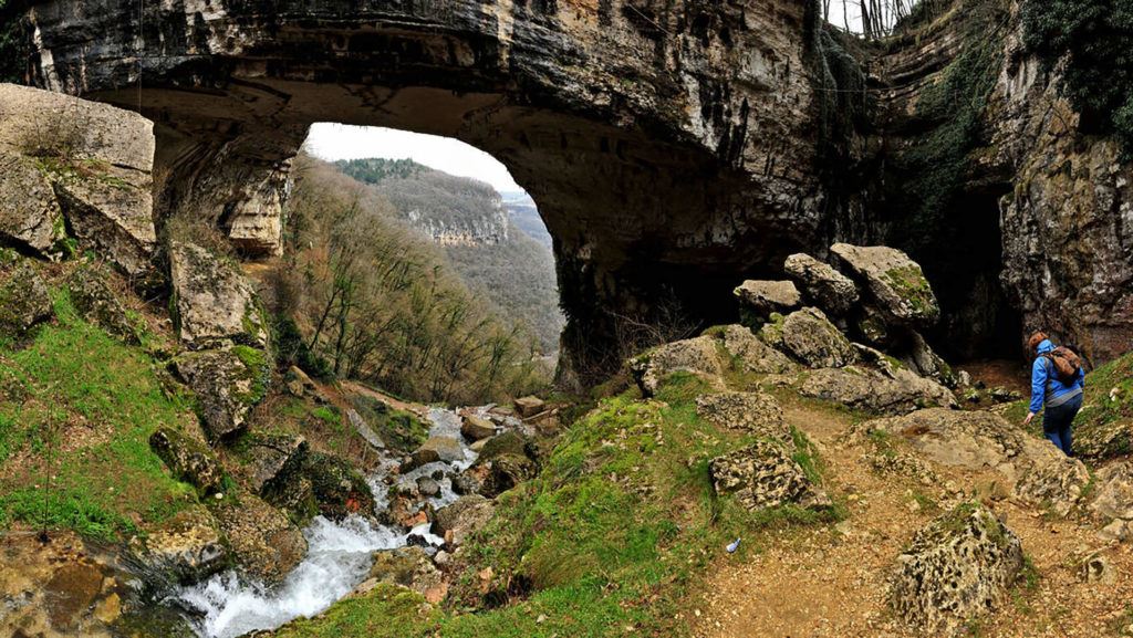
Part of the municipality lies to the north of the Corno d’Aquilio, and is known as Pialda Bassa; this is the location of the Spluga della Preta, a group of karst caves explored to a depth of around 1000 metres, and reputed for many long years to be the deepest known on Earth. Another masterpiece of Nature can be seen in the southern area of Sant’Anna d’Alfaedola, namely the Ponte di Veja, a natural stone bridge overhanging the Vajo dei Falconi. The rear part of a cavern has been slowly eroded, leaving an enormous arch.
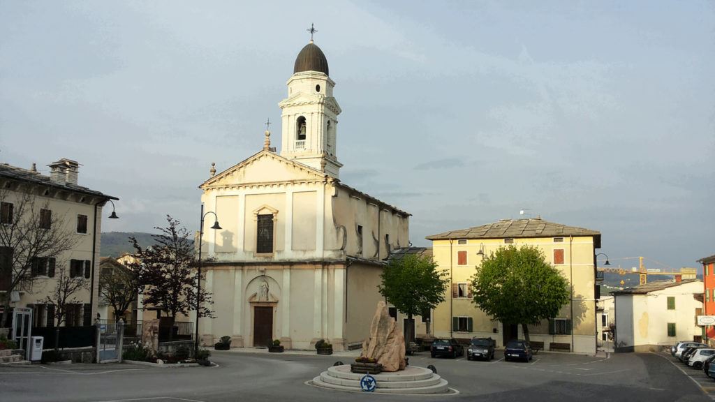
The chief town of the municipality (Sant’Anna) is situated 30 km from Verona and around 16 km from Negrar, another small town of some importance.